
Weather, Terrain, and Technical Limits That Shape Real-World Results
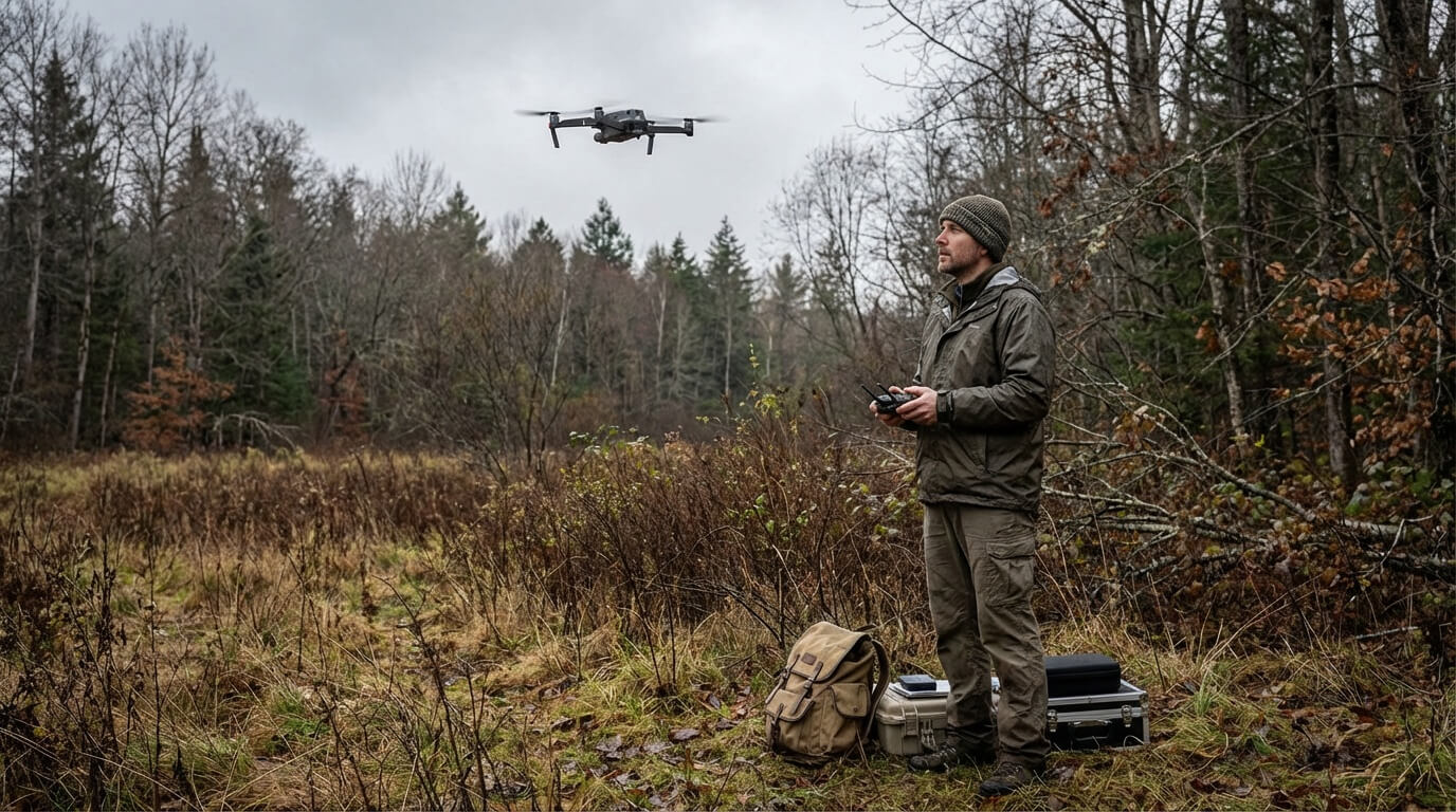
Drone-based wildlife surveys have moved from experimental to operational in less than a decade. They are faster than most ground surveys, safer than crewed aircraft, and capable of collecting spatially rich data at relatively low cost. In ideal conditions, drones can deliver accurate population estimates, habitat assessments, and behavioral observations that were previously impractical.
But ideal conditions are the exception.
Most wildlife surveys occur in forests, wetlands, mountainous terrain, coastal zones, cold regions, or mixed human–wildlife landscapes—exactly the environments where drone performance is constrained by weather, terrain, and operational limits. In these settings, drone surveys rarely “fail” dramatically. Instead, they fail quietly: batteries drain faster than planned, imagery degrades just enough to miss detections, or processing bottlenecks delay analysis until conditions have changed.
This article examines when and why drone wildlife surveys break down in challenging conditions, and—more importantly—what mitigation strategies are supported by field evidence rather than marketing claims. The goal is not to discourage drone use, but to help agencies and land managers design surveys that reflect real-world constraints from the outset.
For a technology-agnostic comparison of monitoring methods, see:
Wildlife Monitoring Technology Tools: What Actually Works (Evidence).
Table of Content
- Weather, Terrain, and Technical Limits That Shape Real-World Results
- Quick Reference: When Drone Surveys Work—and When They Don’t
- I. Why Drone Wildlife Surveys Break Down Outside Ideal Conditions
- II. Weather Constraints That Define Survey Feasibility
- III. Terrain and Habitat Constraints That Reduce Data Quality
- IV. Technical Limits That Cap Survey Effectiveness
- V. Mitigation Strategies That Actually Work
- VI. Case Study: Recovering Accuracy in a Wetland Turtle Survey
- VII. When Drones Are the Wrong Tool
- VIII. Decision Framework: Go, Modify, or Don’t Fly
- IX. Key Takeaways
- FAQ
Quick Reference: When Drone Surveys Work—and When They Don’t
Most reliable when:
- Weather is predictable within a short planning window
- Target species are detectable from above (visual or thermal contrast)
- Canopy cover is limited or patchy
- Surveys are short-duration and episodic
High-risk or poor fit when:
- Canopy cover exceeds ~70%
- Sustained winds exceed ~8 m/s
- Persistent fog or low cloud limits visibility
- Continuous or long-duration monitoring is required
- Regulatory or public-perception constraints dominate
Rule of thumb: If three or more red flags apply (see the full list in Section VIII), drones should not be the primary monitoring tool.
I. Why Drone Wildlife Surveys Break Down Outside Ideal Conditions
Most public-facing examples of drone wildlife surveys come from demonstrations conducted under favorable conditions: calm winds, clear visibility, open terrain, and flexible timing. These examples are useful, but they do not reflect the operational reality faced by most wildlife agencies.
In practice, these constraints compound each other:
- Wind increases power consumption, which shortens flight time and reduces terrain-following accuracy.
- Cold temperatures reduce battery capacity, limiting payload options and safety margins.
- Dense canopy forces lower flight altitudes, increasing collision risk and regulatory complexity.
- Regulatory constraints can negate technical solutions that appear viable on paper.
GNSS signal quality and positional accuracy are empirically shown to degrade under canopy cover in positioning studies.
When these interactions are ignored, failure often presents as “poor data quality” rather than an obvious operational error. Detection rates fall, imagery becomes inconsistent, and post-processing cannot recover information that was never captured reliably.
This article focuses on forests, wetlands, mountainous terrain, cold regions, with brief attention to urban and suburban environments where human–wildlife conflict surveys are common. Throughout, constraints are framed as design parameters to plan around, not reasons to abandon drones outright.
II. Weather Constraints That Define Survey Feasibility

Weather determines whether drone wildlife surveys produce usable data more than any other factor.
A. Wind: The Dominant Operational Constraint
Wind affects drone surveys through three mechanisms:
- Increased energy consumption
Flying against wind increases aerodynamic drag, accelerating battery depletion and shortening effective flight time. - Flight instability and image degradation
Gusts and wind shear cause altitude drift and lateral movement, increasing motion blur and degrading photogrammetric alignment. - Safety margins
Strong or variable winds increase the risk of loss of control, especially near canopy edges, ridgelines, and built structures.
Across field deployments, sustained winds above ~8–10 m/s consistently mark the transition from degraded performance to unacceptable data loss for multirotor platforms. This 8–10 m/s range represents conservative operational practice among wildlife agencies, not manufacturer survivability ratings. Many platforms advertise wind resistance of 12–15+ m/s, but these values reflect the aircraft’s ability to remain airborne—not its ability to collect reliable data.
Wind tolerance varies by platform:
- Consumer multirotors: performance often degrades well below advertised limits
- Industrial multirotors: improved stability, but still subject to rapid battery drain
- Fixed-wing platforms: better tolerance of steady wind, poor tolerance of gusts and constrained landings
In practice, gustiness and turbulence often matter more than mean wind speed, and ground-level forecasts frequently underestimate conditions encountered at survey altitude.
B. Temperature Extremes and Elevation
Temperature affects both battery chemistry and aerodynamics.
Cold conditions commonly reduce lithium-polymer battery capacity by 30–50%, even when voltage appears nominal at launch. While cold air slightly increases lift, battery losses dominate, shortening endurance and reducing payload flexibility.
High temperatures introduce thermal stress and accelerate battery degradation, though short-term performance loss is typically less dramatic than in cold environments.
High-elevation surveys compound both effects. Reduced air density decreases lift efficiency, further shortening flight time and limiting sensor payloads. Terrain-following flight plans at elevation—where the aircraft continuously adjusts altitude to maintain ground clearance—add additional battery drain.
C. Precipitation and Humidity
Rain and high humidity degrade drone surveys through multiple pathways:
- Electronics exposure: “Weather-resistant” does not mean waterproof under sustained exposure.
- Sensor degradation: Thermal infrared sensors experience reduced signal-to-noise ratios in humid air.
- Increased power draw: Moisture accumulation on airframes and propellers increases drag and weight.
Even light precipitation often invalidates data quality. As a result, most wildlife agencies adopt conservative policies that avoid flying during any active precipitation event.
D. Visibility Constraints: Fog, Low Cloud, and Atmospheric Moisture
Visibility limitations are among the most common causes of mission cancellation, particularly in coastal, wetland, and valley environments.
Fog and low cloud:
- Reduce RGB and thermal image clarity
- Prevent compliance with visual line-of-sight requirements
- Increase collision risk near terrain and canopy
Operationally, visibility below ~1–2 km often makes drone surveys non-viable, even when wind and precipitation are within acceptable limits. Localized fog—common in wetlands and mountain valleys—is frequently missed or under-predicted by standard weather forecasts, making visibility one of the hardest constraints to plan around.
Operational wind limits, visibility requirements, and visual line-of-sight rules align with guidance published by the UAS wildlife research review from Christie et al. 2016
Operational Weather Envelope (Conservative Field Practice)
- Wind: ≤8 m/s sustained (gusts matter more than averages)
- Temperature: ~0°C to 35°C (battery conditioning required near limits)
- Visibility: ≥1–2 km to maintain visual line-of-sight and data quality
- Precipitation: Avoid all active precipitation
Note: These thresholds reflect conservative operational practice among wildlife agencies and researchers, not manufacturer survivability ratings.
III. Terrain and Habitat Constraints That Reduce Data Quality

A. Forested Landscapes
Forests present the most widespread constraints on drone wildlife surveys:
- Canopy cover above roughly 70–80% typically renders visual detection unreliable for most species.
- GNSS multipath errors—where satellite signals bounce off vegetation before reaching the receiver—can degrade positional accuracy from ~3 m to 10–15 m under dense canopy.
- Low-altitude flight (<30–40 m AGL) increases collision risk and limits reaction time.
RTK-GPS (Real-Time Kinematic GPS, which uses ground-based correction stations to achieve centimeter-level positioning) improves spatial accuracy but does not solve detection limits caused by canopy obstruction.
In densely forested environments, acoustic monitoring systems often outperform drones for species detection, particularly for vocal or nocturnal species.
(See: Acoustic Monitoring for Nocturnal and Elusive Wildlife.)
B. Wetlands and Flooded Habitats
Wetland surveys introduce distinct challenges:
- Limited takeoff and landing zones
- Elevated recovery risk in the event of malfunction
- Regulatory proximity constraints near protected waters
Operationally, wetland surveys often require flight altitudes below 30 m, increasing collision risk and exposure to wind shear. While drones can outperform ground methods in inaccessible wetlands, abort planning and redundancy are essential.
C. Mountainous and Rugged Terrain
Mountain environments combine multiple stressors:
- Steep slopes and shadowing degrade image alignment
- Rapid temperature shifts affect battery performance mid-flight
- Terrain-following flight plans increase power consumption
Field deployments in alpine regions document persistent data gaps in photogrammetry and LiDAR surveys under variable conditions, even with high-end platforms.
D. Urban and Developed Landscapes (Brief Context)
In suburban and urban wildlife surveys, technical constraints are often secondary to regulatory, privacy, and public-perception barriers. Airspace complexity, line-of-sight rules, and public scrutiny frequently dictate survey design more than environmental conditions.
IV. Technical Limits That Cap Survey Effectiveness
A. Battery Endurance and Payload Tradeoffs
Real-world flight times rarely match manufacturer claims. Slow, low-altitude, terrain-following surveys often reduce endurance by 30–50% relative to advertised specifications.
Each additional sensor increases payload weight, reducing:
- Flight time
- Safety margins
- Recovery options
In challenging conditions, simpler sensor packages often outperform complex ones by preserving endurance and consistency.
B. Sensor Performance Under Stress
Environmental stress amplifies sensor limitations:
- RGB imagery degrades under motion blur and shadowing
- Thermal sensors lose contrast in warm or humid conditions
- Detection errors propagate directly into abundance estimates
For a detailed comparison of thermal detection and alternative methods, see:
Thermal Imaging vs eDNA for Wildlife Monitoring.
C. Data Storage and Processing Bottlenecks

High-resolution drone surveys generate large datasets:
- A single 20-minute 4K RGB survey can produce 50–100 GB of raw imagery.
- Photogrammetry processing often requires 4–8× the flight time on standard workstations.
Photogrammetric pipelines like SfM–MVS are documented in academic workflows that require intensive computation and structured processing pipelines.
If weather limits flights to one viable window every few days, processing delays can collapse effective survey cadence. For example, if processing takes three days but flights are only possible every five days, teams may fall behind before the next window opens.
In practice, data throughput becomes a limiting factor as often as flight performance.
D. Regulatory and Operational Constraints
Altitude caps, line-of-sight rules, and BVLOS restrictions constrain survey design. Even when technical solutions exist, regulatory barriers may prevent their use.
V. Mitigation Strategies That Actually Work
Mitigation is most effective when prioritized by impact, cost, and implementation time.
A. High-Impact, Low-Cost First Steps
- Timing flights for dawn or dusk: Temperature differentials between animals and surroundings are often 5–10°C greater during these periods, significantly improving thermal detection rates even with consumer-grade sensors.
- Wind-perpendicular transects: Reduce drift, stabilize ground sampling distance, and preserve battery by avoiding prolonged headwind legs.
- Conservative abort thresholds: Prevent partial datasets that cannot be salvaged and protect aircraft recovery margins.
These steps often yield greater gains than hardware upgrades because they reduce the dominant failure modes—motion blur, drift, and weak thermal contrast—before adding cost or complexity.
B. Mid-Cost Hardware and Software Upgrades
These upgrades improve consistency, especially in variable terrain or when repeatability matters.
- RTK-GPS upgrades: $2,000–$8,000 depending on system and base-station requirements
- Battery insulation and pre-warming: same-day implementation (often the fastest cold-weather improvement)
- Wind-tolerant industrial frames: $5,000–$25,000 depending on payload and redundancy
Implementation timelines range from days (battery practices) to 1–2 weeks for RTK setup and training.
C. High-Cost or Scale-Dependent Solutions
These options are usually justified only when surveys are repeated at program scale or when access constraints are extreme.
- Fixed-wing platforms: improved coverage and steady-wind tolerance but require landing zones and higher operational complexity
- BVLOS waivers: typically 6–18 months in the U.S., often $10,000+ in consulting/legal costs and compliance preparation
- Hybrid sensor deployments: powerful but may worsen endurance and processing constraints if not carefully scoped
D. Practical Troubleshooting Logic
- Wind instability: First adjust timing to calmer morning or evening windows. If wind persists, shorten transect legs to keep the aircraft closer to launch points and preserve return power. If neither works, consider [Acoustic Monitoring for Nocturnal and Elusive Wildlife] or [AI-Powered Wildlife Monitoring Camera Traps] methods that are less weather-dependent.
- Canopy interference: Lower altitude cautiously where safe, add RTK-GPS for positional accuracy, or switch to non-visual detection methods when canopy cover remains the limiting factor.
- Processing bottleneck: Reduce resolution, restrict imagery to priority zones, stagger missions, or shift objectives from mapping to detection so analysis can keep pace with weather windows.
Peer-reviewed studies in Remote Sensing in Ecology and Conservation and recent work on thermal drones highlight how flight path optimization improves detection efficiency.
VI. Case Study: Recovering Accuracy in a Wetland Turtle Survey
In a South American wetland system dominated by patchy canopy and frequent wind, early drone thermal surveys of mass-nesting river turtles achieved ~62% detection accuracy, with missed detections driven by motion blur and canopy interference.
This example is drawn from published research conducted in 2025 evaluating drone-based abundance estimation under multiple detection error sources.
Interventions:
- Shifted flights to early dawn to maximize thermal contrast
- Shortened transect legs to reduce drift and motion blur
- Applied post-survey error modeling to account for missed detections
Result:
Detection accuracy improved to ~89%, producing reliable abundance estimates without hardware upgrades.
The key lesson was not better sensors, but timing, flight design, and error correction.
VII. When Drones Are the Wrong Tool

Drone wildlife surveys are typically a poor fit when:
- Canopy cover consistently exceeds ~70%
- Weather windows are persistently narrow
- Continuous monitoring is required
- Regulatory or public-perception constraints dominate
In these cases, camera traps, acoustic monitoring, or indirect methods often outperform drones.
(See: AI-Powered Wildlife Monitoring Camera Traps and Acoustic Monitoring for Nocturnal and Elusive Wildlife.)
VIII. Decision Framework: Go, Modify, or Don’t Fly
Red flags (don’t fly if 3+ apply):
- Sustained winds forecast above ~8 m/s
- Canopy cover >70%
- Multiple days of expected precipitation or fog
- No clear takeoff/landing zones (>20 m radius)
- Regulatory restrictions unclear or prohibitive
- Data processing capacity already backlogged

IX. Key Takeaways
- Most drone survey failures are predictable
- Better planning often beats better hardware
- Drones work best as part of integrated monitoring systems
Emerging technologies—AI-assisted flight planning, improved cold-weather batteries, streamlined BVLOS approvals—may ease some constraints. But environmental physics will continue to shape survey design for the foreseeable future, making constraint-first planning essential regardless of technological advances.
FAQ
Drones should not be used when environmental, regulatory, or operational constraints exceed safe or reliable limits. This includes situations with sustained winds above conservative operational thresholds, persistent fog or poor visibility, dense canopy cover that prevents detection or accurate positioning, lack of safe takeoff and landing zones, or regulatory restrictions that prevent legal flight. In these cases, alternative methods such as camera traps, acoustic monitoring, or indirect survey techniques often produce more reliable data with less risk.
Weather determines whether drone wildlife surveys produce usable data more than any other factor. Wind increases power consumption and motion blur, reducing image quality and flight endurance. Cold temperatures can reduce battery capacity by 30–50%, while humidity, fog, and precipitation degrade sensor performance and may violate visual line-of-sight requirements. Even when drones remain airborne, weather-driven effects often introduce detection errors or force abbreviated surveys that compromise data quality.
Drone surveys can be more accurate than ground surveys in specific contexts, such as counting animals in open habitats or detecting heat signatures with thermal sensors under optimal conditions. However, accuracy depends on environmental conditions, survey design, and error modeling. In forests, wetlands, or poor weather, drones may miss individuals or introduce bias. In many cases, drones perform best when combined with ground-based methods rather than used as a replacement.
References
Christie, K. S., Gilbert, S. L., Brown, C. L., Hatfield, M., & Hanson, L. (2016). Unmanned aircraft systems in wildlife research: Current and future applications of a transformative technology. Frontiers in Ecology and the Environment, 14(5), 241–251. https://doi.org/10.1002/fee.1281
https://pubs.usgs.gov/publication/70178642
Linchant, J., Lhoest, S., Quevauvillers, S., Vermeulen, C., Michez, A., & Lejeune, P. (2015). Are unmanned aircraft systems (UASs) the future of wildlife monitoring? A review of accomplishments and challenges. Mammal Review, 45(4), 239–252. https://doi.org/10.1111/mam.12046
McCarthy, E. D., Martin, J. M., Boer, M. M., & Welbergen, J. A. (2021). Drone-based thermal remote sensing provides an effective new tool for monitoring the abundance of roosting fruit bats. Remote Sensing in Ecology and Conservation, 7(3), 461–474. https://doi.org/10.1002/rse2.202
Brack, I. V., Kindel, A., & Oliveira, L. F. B. (2018). Detection errors in wildlife abundance estimates from unmanned aerial systems (UAS) surveys: Synthesis, solutions, and challenges. Methods in Ecology and Evolution, 9(8), 1864–1873. https://doi.org/10.1111/2041-210X.13008
Brack, I. V., Valle, D., Ferrara, C., Torrico, O., Domic-Rivadeneira, E., & Forero-Medina, G. (2025). Estimating abundance of aggregated populations with drones while accounting for multiple sources of error: A case study on the mass nesting of giant South American river turtles. Journal of Applied Ecology, 62(8), 2036–2047. DOI:10.1111/1365-2664.70081
Federal Aviation Administration. (2023). Unmanned aircraft systems (UAS) operational limitations and requirements. U.S. Department of Transportation.
https://www.faa.gov/uas
National Oceanic and Atmospheric Administration. (2022). Aviation weather hazards: Fog, visibility, and low-level atmospheric conditions. NOAA National Weather Service.
https://www.weather.gov/aviation
Chang, B., Hwang, B., Lim, W., Kim, H., Kang, W., Park, Y.-S., & Ko, D. W. (2025). Enhancing Wildlife Detection Using Thermal Imaging Drones: Designing the Flight Path. Drones, 9(1), 52. https://doi.org/10.3390/drones9010052
Pettyjohn, S., et al. (2025). Seasonally structured drone data for shoreline change monitoring and photogrammetric workflow application. Scientific Data, 12, Article 63. https://doi.org/10.1038/s41597-025-06310-z
Tomaštík, J., et al. (2023). Static positioning under tree canopy using low-cost GNSS receivers. Sensors (Basel), 23(PMC10056071). https://www.ncbi.nlm.nih.gov/pmc/articles/PMC10056071/
Leave a Reply